Why do GPS systems give wrong directions?

A GPS device.
AP Photo/Reed Hoffmann

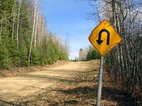
Maybe you've heard the stories of people driving into lakes or other hazards because their GPS device told them to, or maybe you've experienced some wonky directions from your own GPS -- routing you the wrong way on the highway or down a closed road.

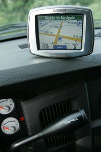
It's estimated that as many as 560 million GPS handsets will be in use around the world by 2012, up from 175 million in 2007 [source: Meyer]. Although many of us would be lost without following the step-by-step course relayed by our computer passenger, it can be a risky plan sometimes. GPS isn't foolproof. Before we can understand how it can go wrong, we need a basic understanding of how it works. Very simply, GPS receivers use a combination of signals from a network of satellites and ground stations to figure out where you are and where you'd like to go. That information is then overlaid onto maps that are stored on your device.

Advertisement

No matter how expensive a GPS device is, when it comes to getting where you want to go, it's really only as good as the satellite network and its map data. The first strike against GPS is that satellite signals aren't 100 percent accurate -- for instance, they can't determine your precise location. They're pretty close though, within 164 to 328 feet (50 to 100 meters) [source: Corvallis Microtechnology Inc.].

­The second strike is that maps quickly go out of date. The directions your GPS device compiles are based on digital maps provided by a mapping and navigation company that has partnered with the device manufacturer. Without the most up-to-date maps, you're out of luck. Let's look in more detail at the reasons why your GPS device might lead you down the wrong path, from mapping problems to bad satellite signals.

Advertisement

GPS Driving Directions: Led Astray by GPS

Sometimes your GPS device might leave you wondering where you are.
iStockphoto/wolv

You probably wouldn't trust an old map you unearthed from the trunk of your car to help plot the most accurate route, so why haven't you updated the maps on your GPS device? You'll never get from Point A to Point B with inaccurate or outdated information.

Each year, you can expect roads to change as much as 40 percent -- that's new roads, closed roads, lane changes, you name it [source: Tele Atlas]. Think about new developments in your own town -- construction may go on for months or years until one day the roads suddenly open. Eventually those new roads will make it into the next version of digital mapping software, but it isn't instantaneous. How does it happen? The major mapping and navigation companies use a combination of on-the-ground technology (employees driving around and collecting data), user feedback and a variety of other sources to build maps that reflect the reality of the road systems around the world. In a study by the Navigations Systems Research Foundation, it was discovered that some important information is sometimes overlooked by GPS systems, such as types of roads. This is important information to have if your bus has accidentally been routed through a residential neighborhood or your car has been detoured to an unpaved road.

Advertisement

While the map data is at fault for inaccuracies, users are usually at fault for outdated data. Many handheld or stand-alone devices can be updated for free by connecting them or the removable media card directly to a computer and downloading new, updated maps from the digital map provider. With frequent downloads, your GPS device will have the most current routing information.

Even with the most up-to-date mapping and navigation software, your GPS device is still at the mercy of its satellite network. Accuracy problems can arise from a variety of conditions, from atmospheric to terrestrial. When a satellite isn't able to transmit its position, a situation called an ephemeris or orbital error, it isn't able to establish a link with your GPS device. Atmospheric conditions, specifically in the ionosphere and troposphere, including variations in plasma activity, temperature, pressure and humidity, can cause calculation and accuracy errors in the satellite network.

Bad satellite signals and signal interference are some of the most common glitches and happen when something gets in the line of sight between your GPS device and the satellite network. Without a clear and strong signal, your device can't accurately establish your location. Tall buildings, dense foliage, mountains and even reflective objects can cause such a problem.

To be sure you always get from Point A to Point B, update your mapping software often and always bring a map.

Advertisement

Lots More Information

Related HowStuffWorks Articles

  • "GPS Steering You in the Wrong Direction?" ABC News. 2008.http://abcnews.go.com/GMA/Consumer/story?id=4136269
  • "Introduction to the Global Positioning System for GIS and TRAVERSE." Corvallis Microtechnology, Inc. 2000. http://www.cmtinc.com/gpsbook/index.htm
  • Meyer, David. "Boom predicted for GPS-enabled handsets." CNET News. 2008. http://news.cnet.com/Boom-predicted-for-GPS-enabled-handsets/2100-1039_3-6226211.html
  • Navteq. http://www.navteq.com/
  • Ray, Bill. "Half of GPS users given duff information." The Register. 2007. http://www.theregister.co.uk/2007/08/04/gps_wrong_half_the_time/
  • Shaw, Keith. "GPS data wrong? Now you can help." NetworkWorld.com. 2007. http://www.networkworld.com/community/?q=node/10299
  • Tele Atlas. http://www.teleatlas.com/index.htm

Advertisement

Loading...